The Katy Trail
- At 237.7 miles the Katy Trail is THE LONGEST continuous rail trail in the United States.
- There are over 30 bridge crossings along the Katy Trail, including over the Missouri River!
- There are 26 trailheads and many of them feature refurbished cabooses once used on the rail line.
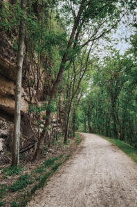
- Scenes along the Katy Trail include deciduous forests, open farmland, bluffs and cliffs, expansive prairies, and the Missouri River!
- There are four fully restored historic depots to visit.
- The Katy Trail is great for cyclists of all skills and rarely exceeds a gradient of 5%.
- The Katy Trail is surfaced with crushed limestone. In certain sections it takes on a subtle pink or tan hue due to the local Missouri quarries from where it was sourced.

Katy Trail and Rock Island Trail Map
Katy Trail Elevation
If on a phone, turn horizontal for best view.
Katy Trail Elevation Profile
Katy Trail Mileage
If on a phone, turn horizontal for best view.
Katy Trail Mileage Chart
Katy Trail History
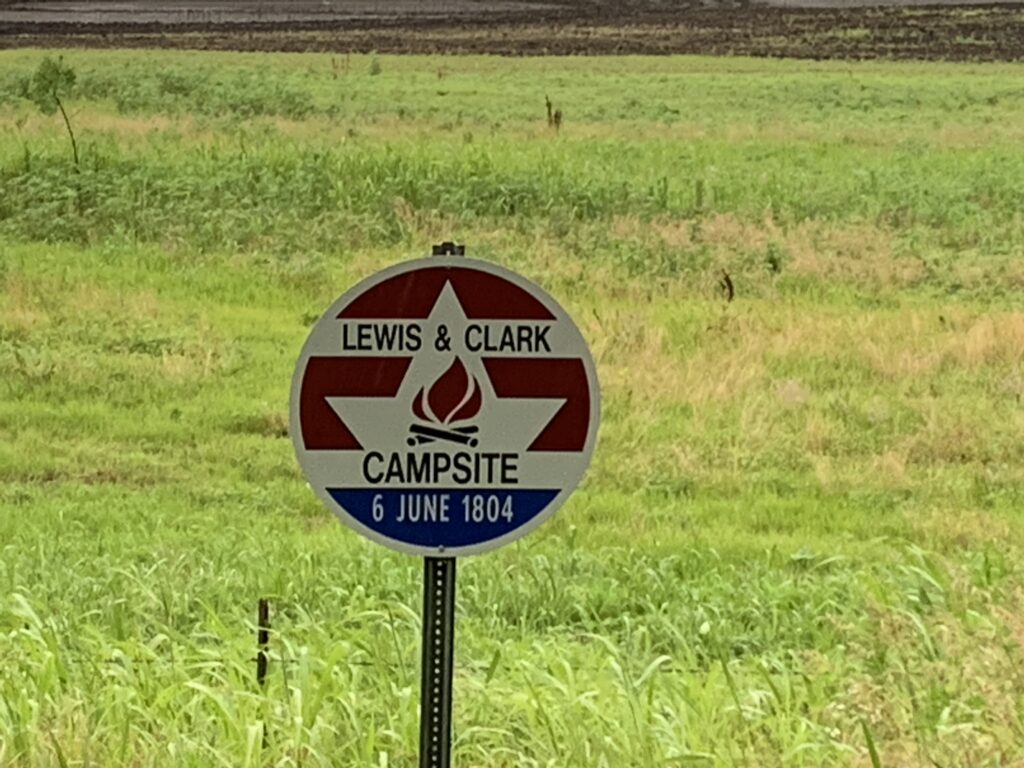
In 1804, Lewis and Clark began the Lewis and Clark Expedition in St. Charles, Missouri, which lies just three stops in on the eastern side of the trail. Along the trail there are historical markers indicating events on the expedition.
The Katy Trail as it is known today was once a functioning railroad line, the construction of which has its roots in the post-Civil War railroad boom. The line became known as the Missouri-Kansas-Texas Railroad, or, the MKT (from which the “Katy” gets its name). This line once extended into Kansas, Oklahoma, and deep into Texas.
The trail’s western line was built between 1870 and 1871 by the Tebo & Neosho Railroad, which laid tracks connecting Sedalia to Clinton. By 1873, the line pushed further north to Boonville, and with the completion of the first Missouri River bridge there in 1874, the “Katy” became a vital artery for moving cattle and goods from the Southwest into the heart of Missouri.
The trail’s eastern stretch, the “St. Louis Extension,” was built between 1892 and 1895. This section was designed to give the MKT Railroad direct access to St. Louis by hugging the limestone bluffs of the Missouri River. During this expansion crews blasted through solid rock to create the Rocheport Tunnel (1893) and established the path through St. Charles.
Today, whether you are cycling through the historic rail hub of Sedalia or tracing the river bluffs near Rocheport, you are traveling a corridor rich in history and originally built with 19th century ingenuity and engineering.
The journey from a bustling railroad to the nation’s longest continuous rail-trail began unexpectedly in October 1986. After a series of devastating floods damaged the MKT line between Sedalia and Machens, railroad officials decided the cost of repairs was too high and moved to abandon the route. This coincided with a new federal legal tool known as “railbanking.” Under the National Trails System Act, the corridor was preserved as a continuous strip of land for future transportation needs while being “banked” for interim use as a public park. This innovative move prevented the land from being carved up and sold off, keeping the historic pathway intact for future generations.
The project’s survival was largely due to the vision and generosity of Edward “Ted” Jones (of the Edward Jones investment firm) and his wife, Pat Jones. Inspired by rail-trails they had seen in other states, the couple donated more than $2.2 million to help the Missouri Department of Natural Resources acquire the right-of-way and begin construction. Despite significant opposition from some local landowners and the massive setbacks caused by the Great Flood of 1993, which washed away large portions of the newly built path, the project persevered. The very first segment of the Katy Trail officially opened in Rocheport in 1990, marking the birth of what would become a Hall of Fame destination.
By the late 1990s, the trail reached its major western hub in Clinton after the Union Pacific Railroad donated the final 33-mile segment from Sedalia. Today, the Katy Trail State Park serves as a national model for the “rails-to-trails” movement, proving that an abandoned industrial relic can be transformed into a vibrant economic engine. What was once a corridor for steam engines is now a 240-mile journey through Missouri’s history, connecting rural towns and scenic river bluffs to over 400,000 visitors each year.